")
Have you ever wondered how a ship or aircraft can travel for thousands of kilometers to a specific destination without going off course? Or have you been fascinated by how many of these crafts can move around and avoid colliding with barriers or with one another? If you have, your answer is right here. These are the wonders of navigation.
According to Guinness World Records, the longest distance sailed nonstop by a vessel is 131,535 km or 81,732 miles. Australian yachtsman Jon Sanders achieved this feat in March 1988.
Imagine seeing nothing but deep blue seas and blue skies for the better part of nearly two full years. Yes, that’s the price Stewart paid as he travelled on his 44-foot-long vessel, Parry Endeavor. The ship set off on this daring adventure on May 25, 1986, from Fremantle, Western Australia. It arrived at the same location on March 13, 1988, having gone around the globe three complete times.
Jon Stewart’s accomplishment wouldn’t have been possible without the advanced navigation technology available at the time. At any point in the journey, sailors would need to know if they are on the right course. Also, navigation helps them know how far away from their destination they are.
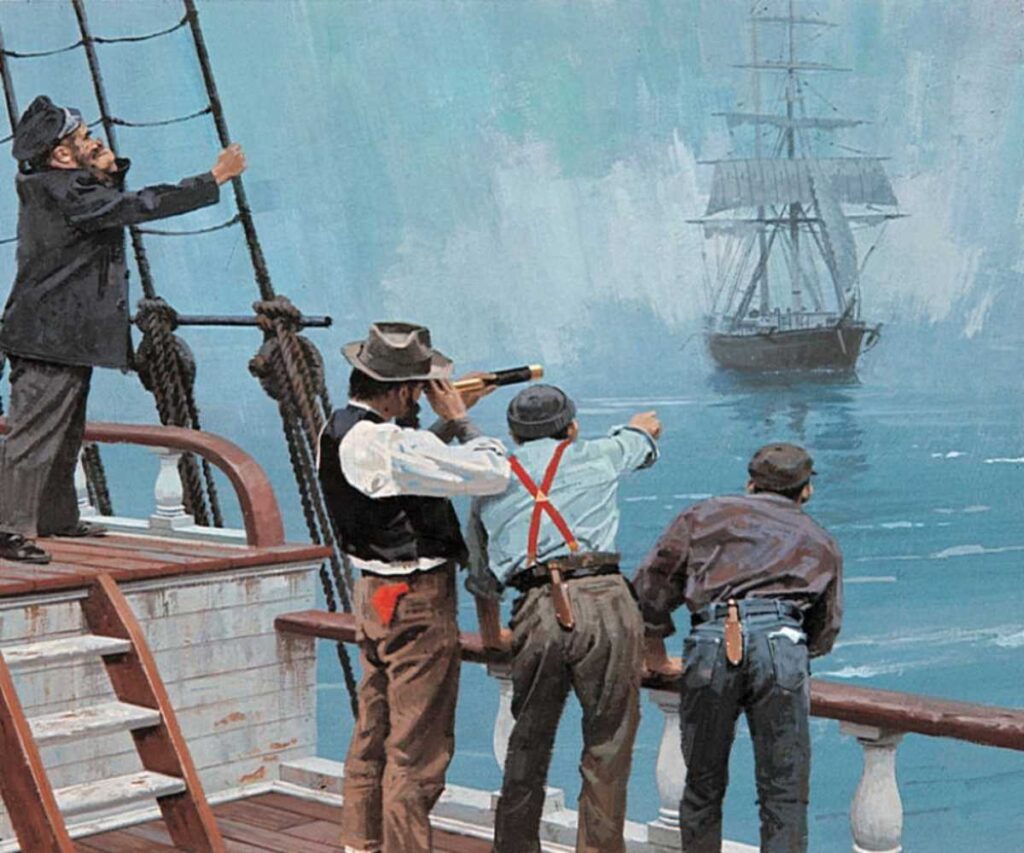
Sailors would also like to know if there are obstacles ahead to avoid. That’s because the slightest of collisions could cause a ship to sink and prove dangerous to the lives and cargo on board. Thankfully, humans have been able, through advancements in navigation technology, to find effective solutions to these concerns.
But it hasn’t been an easy journey getting to where we are today with the high-tech and satellite-assisted navigation. There was a time when mankind had to rely on the crudest tools and high-risk navigation techniques to conquer the deception of the seas. Let’s see the problems that warranted the quest for navigation and where it all began.
The Intimidating Challenge of Maritime Navigation
Moving through the vast water bodies of the globe is like sauntering through a thick crowd of people in search of one person. With at least 71% of the earth being covered with water and the Pacific Ocean larger than all the continents combined, the sea is easily the most treacherous mode of transportation.
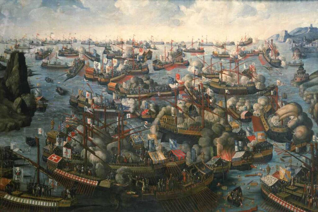
There are a thousand and one reasons why a voyage through the sea could result in tragic outcomes. The sinking of the RMS Titanic on April 14, 1912, is just one of many examples of how merciless the seas could be. Hence, humans have invested a lot in ensuring that incidents such as that happen as frequently as possible.
To ensure safe and fast sea travel, experts have designed navigation systems to solve problems such as adverse weather and collisions. Notably, we have designed systems to keep ships of various sizes that are moving at different speeds from ramming into one another.
The bigger challenge in this area has been the very large ships, which although are easier to spot, are the slowest in changing direction to avoid obstacles. A wrong attempt by one ship to evade collision could trigger a domino effect of collisions in a small area with many vessels.
To solve this problem, navigation experts had to find a way to design lanes for each vessel. They restricted sea vessels to specific pathways, which they also made sure to introduce into the ship’s navigation regulations.
Another challenge or motivation for navigation system advancement is fuel economy. Even though ships can carry much more fuel than they require for their journey, the excess fuel would reduce the amount of cargo the ship could contain.
Also, there were safety concerns attached. The more fuel on board a ship, the less safe the vessel will be.
Moreover, the safety of travel depends on the success of each ship’s journey. That is, the failure of individual ships to arrive at their destinations will spell danger for other ships. The safety of a ship relies greatly on other vessels keeping to their own end of the bargain. That is, meeting up with their arrival and departure schedules.
In a nutshell, experts had to ensure that they built navigation systems that guaranteed safe travel for all ships by solving the problem of fuel consumption. Also, navigation systems must keep vessels in safe lanes and free from obstruction by other carriers or natural elements.
The First Attempts at Navigation
Let’s take a look at the earliest and most primitive navigation techniques ever used. Plus, it’s exciting to see how they continued to evolve through human brilliance and determination for problem-solving.
Mountains, Stars, and Dead Reckoning (3000 – 1100 BCE)
The birth of navigation came around 3000 BCE. At the time, the only option available to sailors was by “trial and error.” After a series of sea travels, they were able to mark out multiple landmarks that guided them to the destinations. This system of navigation is known as “piloting.”
With this system, landmarks, which were mostly mountains, were used as reference points for their journeys. To do this, the vessels had to stay close enough to land all through the journey. These landmarks were then documented to serve as a guide for future travels.
Ancient sailors also made use of a navigation technique known as “dead reckoning.” This method had them estimating their current position using their past position. Interestingly, this method doesn’t rely on wind speed or the direction of ocean currents. It only makes use of a mathematical analysis of time, speed, and direction.
This isn’t to dismiss the genius of a good number of sailors who based their navigation solely on environmental or weather factors. These sailors used the directions of shadows to determine North and South.
The sailors could also tell the South wind from the North wind. Of course, the winds from the South are warm, while those from the North are cold. Mariners noticed 8 different types of winds, all of which they named.
This knowledge was what led to the creation of the wind rose – an 8-directional diagram that showed the direction of winds. Many people credit the ancient Central-Italian Etruscan people for its creation around the 6th century.
The position of the sun from sunrise to sunset gave them a clue about the east-west directions. They knew the age-old fact that the sun rises from the East and sets in the West.
Aside from landmarks, weather clues, and dead reckoning, records emerged of sailors making use of celestial bodies as markers. The knowledge of how they found their way through the oceans by the constellations has remained a mystery to date. But sources such as the Greek literary giant, Homer, and the Greek historian and geographer, Herodotus, confirm this.
Homer was the author of the Odyssey, the book that explained one of the most fascinating Greek legends. In the story, one of the characters, Calypso, told the legend of Odysseus to use the Orion-Pleiades star pillar for navigation as he took his night journey through the sea.
Calypso also notably instructed Odysseus to take note of part of the constellation which the Greeks called Artos, the Bear. Calypso told Odysseus to keep the Bear to his left side as he journeyed. Also, the Norse saga talked about the use of celestial bodies for navigation.
Celestial navigation remained, for centuries, the most trusted means of direction through the sea. Sailors created elaborate star maps detailing the necessary signs and directions for the journey.
Ancient records show that the Minoans of the Crete islands referenced constellations as a guide for their journeys between (3000 – 1100 BCE). The most notable routes during this period were the trade route between Crete and Egypt.
The ships covered this distance, which measured about 500 km in 5 days. But as time went on, curiosity drove sailors to cover longer distances, although with multiple stops. Slowly but steadily, ships travelled thousands of kilometers with 3 or 4 stops in between.
By 600 BCE, the Phoenicians, the ancient Semitic tribe who earned a reputation for their outstanding seafaring skills, had begun bringing goods from the British Isles. This tribe, which inhabited the region of present-day Lebanon and Syria, were remarkable traders.
They traded goods such as timber, linen, wine, metals, and dyes. From their abundance of timber, they built all manner of high-demand ships. With these, they crossed intimidating waters and brought in goods from very distant lands.
Most notoriously, the Phoenicians imported Tin from Cornwall in the British Isles. There were also popular travels by the Vikings, the Irish, and by 400 BCE, the journies of the French Polynesians from the Marquesan Islands to as far as Hawaii, about 3700 km away.
The Pilot Book (400 BCE)
The creation of the pilot book marked another win in the evolutionary journey of navigation technology. Also called periplus, it was a manuscript showing a list of visual references to direct the movement of a vessel. The pilot book had drawn on it the locations of various ports and other coastal landmarks.
It also showed how close they were to one another. So, using these indicators together with their distances, the sailor could anticipate what to see next on the way. With these markers, they would steer the ship on a pre-determined path to their destinations.
This method began around 400 BCE. It helped many sailors not to veer from their destination. All they needed to know was that they weren’t on course was to miss sight of the next landmark.
Further Attempts
The ingenuity of mankind would never be satisfied with inventions. Man continued to search for better solutions for navigation. Let’s see the fruits of these further attempts.
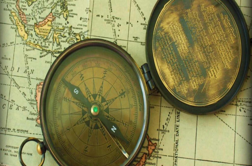
The Lodestone and the Magnetic Compass
A lodestone is a naturally magnetized mineral which is a type of Magnetite. The mineral was first discovered in Magnesia in ancient Greece. Philosopher Thales of Miletus, has been credited as one of the first to find out about the mineral’s magnetic property. Later on, lodestone will become one of the most useful minerals to sailors.
We don’t know when or by whom, but it was discovered that the lodestone, by default, aligns in the north-south direction just like the iron magnets. Hence, the magnetic compass was born.
There are records of the magnetic compass being used by the Chinese and the French around 1100 BCE. After that, the Arabs and Scandinavians reportedly began to use it widely. However, mariners initially only relied on the compass when the sun, stars, and other landmarks weren’t visible.
The Chinese compasses were oriented to the south. Hence, they were called the “south pointing spoons.” But it comprised a literal metal spoon, placed on a brass plate with several markings indicating 8 cardinal points. The instrument was initially used for fortune-telling before it began to guide ships.
Other uses included the alignment of buildings and navigation during war. Notably, due to wartime pressures, Chinese Emperor Hoang-ti (2700 BCE) began using them to direct his armies through foggy terrain.
The magnetic compass went through a series of brushings up. Initially, the compass comprised a floating needle on a liquid surface. As the needle rested, the pointing end would face the magnetic north. But later on, scientists found a better arrangement.
The scientists placed the needle on a card that was marked with the 4 major cardinal directions. They later increased the compass directions to 32.
At the dawn of the 15th century, scientists discovered that the magnetic north was different from the geographic north. This variation, which differs from location to location, is also called magnetic declination.
Another evolution that was made to the magnetic compass was the building material. Initially, the instrument was made of wood. Afterwards, it came in iron and steel. However, these changes came with some problems. Iron and steel compasses were affected by the magnetism of the ships. This caused some deviation from the accurate compass readings.
Aside from the magnetic compass, there were other compasses like the gyroscopic compass. The gyrocompass, as it is also called, doesn’t use magnetism to measure direction. This more recent compass, which came on the scene at the beginning of the 20th century, comprises a spinning gyroscope. This gyroscope, unlike the magnetic compass’ needle, rests on the true geographic north.
Aside from the gyrocompass, other types of compasses were also used. Prominent among these was the solar compass. Just as the name suggests, the solar compass shows direction based on the position of the sun.
The solar compass emerged in the 19th century and was initially used for land survey. Interestingly, the solar compass is in its basic form, simply a compass card. When placed in the sun, the shadow of the sun reflects on the card, showing the correct direction.
The Astrolabe and Sextant
The story of how early humans navigated the seas cannot be complete without the astrolabe and the Sextant. The astrolabe is a versatile handheld star chart that plots the locations of the celestial bodies.
The instrument was invented by the ancient Greeks sometime between 2000 – 1000 BCE. Some of the early notable users included the legendary Ptolemy of Egypt. The astrolabe was used at sea for measuring elevation angles and the latitude.
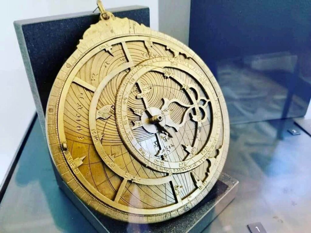
An astrolabe in its basic version contains a disc that houses all the items that make up the equipment. These other items include a degree scale and an hours scale. Also, there is a “rete” at the top of the plate which points out the relative location of specific stars.
The astrolabe also contains a rule which points out positions on the rete and plate and links them to a scale on the rim of the matter. There’s also an alilade positione at the bottom of the astrolade which calculates the altitude of any object in the sky.
The sextant was later invented as an improvement on the astrolabe. They were used to determine the angle between a celestial body and the horizon and then find the latitude. The sextant had mirrors and prisms, unlike the astrolobe. These improved the clarity and legibility of the results.
After using the sextant to measure he angle, the sailor can then use an astronomical almanac to determine the latitude. The knowledge of the latitude helps sailors know what direction they should move.
The Portolano (1200s)
Another tool that can’t be left out of the evolution of navigation is the marine chart. Notable among them is the portolano. This was a chart indicating the location of various harbours. In 1296, a portolano that included the harbours in the whole of the Mediterranean Sea debuted. It was called Lo compasso da navigare.
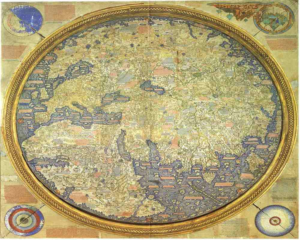
Soon, the portolano underwent improvement to give birth to the more advanced charts, which helped sailors plot their routes from one location to the other. At this time, it was no longer about harbours alone. These advanced maps had multiple rhumb lines of loxodromes, which are curved lines that follow a constant compass bearing.
Not too long after, more advancements were introduced to the marine chart. Due to the curvy nature of the rhumb lines, sailors soon found the need for longitude and latitude-based charts rather than those built upon bearings and distances. That’s how charts like the Mercator were produced.
To date, longitude and latitude have remained a major technique for map reading. Longitude, which specifies East-West position on a map was developed by the study of the moon’s angular displacement from other celestial bodies.
Sailors then developed equipment to help determine these longitudes. These include almanacs and tables. Latitude, which is determined by the altitude of the sun at noon, and which points North-South direction, could be located at sea using the marine chronometer.
The Marine Chronometer (1700s)
In 1714, the British Board of Longitude issued a challenge to the public. They needed someone to develop a method or instrument for finding the longitude for a 30-mile distance while on a journey through the sea. A notable cabinet maker called John Harrison got to work.
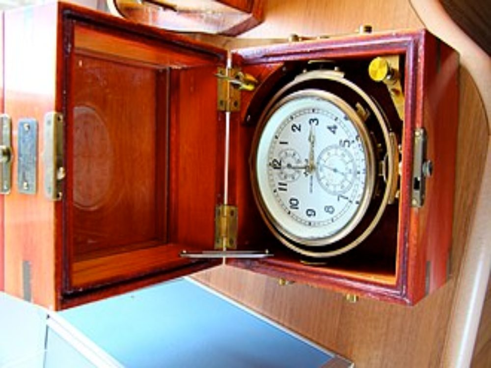
After 40 years, he came up with the marine chronometer. Unlike the pendulum clock that existed before it, the marine chronometer had the advantage of stability. It was unaffected by the influence of the volatile humidity and air temperature. This helped mariners accurately determine their longitude during a voyage.
20th Century Navigation
The dawn of the 20th century introduced modern navigation. The framework for this advancement was laid by scientists who, through complex trigonometric computations, were able to determine the accurate position of a ship.
The pioneers of this endeavor were America’s Thomas H. Sumner and French Marcq Saint-Hilaire, who at separate times in the 1800s developed these calculations. After their input, massive changes in navigation techniques began to roll in.
Radio Navigation
Radio navigation is a system of guiding ships using radio waves. Although similar to celestial navigation, radio navigation relies on radios to help sailors determine their position. After tuning into the radio, the antenna turns towards the direction of the radio antenna.
Radio navigation can also be achieved using electromagnetic waves. This is called radar navigation. The radar system emits electromagnetic waves and records the time the waves take to come back.
This type of radio navigation is especially relevant in times of low visibility. The radar system, a short form of Radio Detection and Ranging, is also useful in detecting the presence of obstacles in the sea.
Another form of radio navigation is the LORAN or Long Range Navigation. LORAN uses radio signals to determine the position of a ship. This is done by calculating the time between radio signal bounces between transmitters that are far from one another.
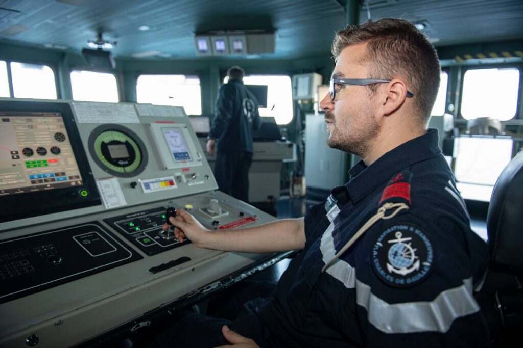
Global Positioning System
Global Positioning System or GPS is a more advanced technique than the radar system. Instead of using radio transmitters, it relies on satellites. It is more accurate than the LORAN system and came on the scene in the 1900s.
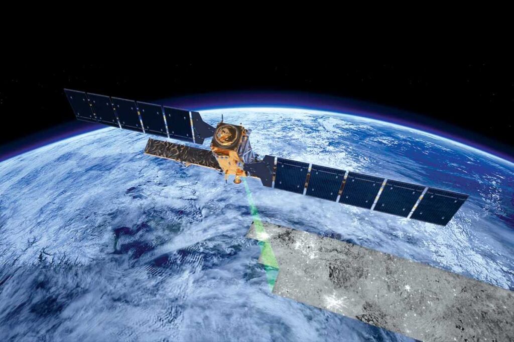
The GPS is sponsored and managed by the United States Department of Defense. The first GPS was created between 1978 and 1985 and comprised 11 satellites. The number of satellites has now increased to 24.
These satellites move around the Earth and relay radio signals. A GPS device can easily pick up these signals and calculate the precise position of the satellites and how long it took for it to transmit. This information then helps to determine the position of the ship. Currently, this is the most accurate and advanced way to determine a ship’s location.